 Oil and Gas Lawyer Blog


Last month the Texas Supreme Court decided three cases involving Texas’ Open Beaches Act. The Court issued one opinion in all three cases: No. 24-0237, Texas General Land Office and Dawn Buckingham, in her official capacity as the Texas Land Commissioner, v. SaveRGV, Sierra Club, and Carrizo/Comecrudo Nation of Texas, Inc.; No 24-0407, Cameron County v. SaveRGV, Sierra Club, and Carrizo/Comecrudo Nation of Texas Inc; and No. 24-0457, Ken Paxton, in his official capacity as Attorney General of Texas, v. Save RGV, Sierra Club, and Carrizo/Comecrudo Nation of Texas, Inc. The cases reminded me of a little Texas history.
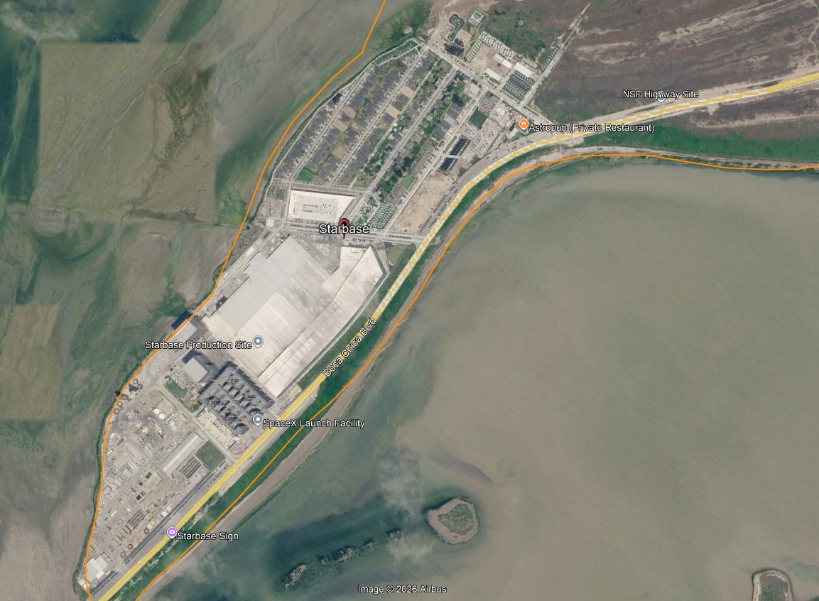
The three plaintiffs filed suit because in 2013 the Legislature passed HB 2623, amending the Open Beaches Act, Tex. Nat. Res. Code Chapter 61, to authorize the General Land Office and Cameron County to adopt rules allowing them to temporarily close beaches “for space flight activities.” The bill passed at the request of SpaceX, which maintains a launch site on Boca Chica Beach on the coast in Cameron County (now incorporated as the town of Starbase. The GLO and the county have at restricted access to Boca Chica beach when SpaceX launches take place.
Plaintiffs claimed that HB 2623 violates Article I, Section 33 of the Texas Constitution, approved by voters in 2009, which states:
(b) The public, individually and collectively, has an unrestricted right to use and a right of ingress to and egress from a public beach. The right granted by this subsection is dedicated as a permanent easement in favor of the public.
(c) The legislature may enact laws to protect the right of the public to access and use a public beach and to protect the public beach easement from interference and encroachments.
(d) This section does not create a private right of enforcement.
“Public beach” is defined as
a state-owned beach bordering on the seaward shore of the Gulf of Mexico, extending from mean low tide to the landward boundary of state-owned submerged land, and any larger area extending from the line of mean low tide to the line of vegetation bordering on the Gulf of Mexico to which the public has acquired a right of use or easement to or over the area by prescription or dedication or has established and retained a right by virtue of continuous right in the public under Texas common law.
The Open Beaches Act, enacted in 1959, makes it unlawful “for any person to create, erect, or construct any obstruction, barrier, or restraint that will interfere with” the public’s right to use and access Texas’ beaches. It charges public officials with the duty of suing to “remove or prevent any improvement, maintenance, obstruction, barrier or other encroachment on a public beach, or to prohibit an unlawful restraint on the public’s right of access to the use of a public beach.” The Open Beaches Act was passed in response to a Texas Supreme Court opinion, Luttes v. State, 324 S.W.2d 187 (Tex. 1958), which in effect made beaches in Texas private property.
Texas is unique in protecting the public’s right of access to beaches. Open beaches in Texas are anchored in its history as first a province of Spain and then Mexico.
The two European legal traditions reaching back to ancient times are the “common law” traditions of Great Britain and the civil law traditions originating from Roman law. Civil law takes the form of legal codes; the common law relies on case law arising from judicial decisions and legally binding precedent. Spain is and was a civil law country, as is Mexico. When Texas was governed by Spain and Mexico it was under their civil codes. Title to lands along most of the Texas coast was granted by Spain and Mexico, and when Texas gained its independence it recognized the validity of those Spanish and Mexican land grants. Texas courts construe Spanish and Mexican land grants according to the laws in effect at the time of the grants. So the seaward extent of those grants is governed by Spanish civil laws in effect at the time.
Spain adopted a legal code first compiled in 1252-1284, Las Siete Partidas (the Seven Parts). One part of that code defines the edge of the shore – the place where private ownership of land grants stops and the edge of the sea begins. Partida 3, Title 28, Law 4:
“ * * * e todo aquel lugar es llamado ribera de la mar quanto se cubre el agua della, quanto mas crece en todo el ano, quier en tiempo del inuierno o del verano.”
This statement has been translated variously. One translation is:
‘* * * and all that place is called shore of the sea insomuch as it is covered by the water of the latter, however most it grows in all the year, be it in time of winter or of summer.
In Luttes v. State, Luttes sued the State for title to 3,400 acres of mud flats adjacent to his land in the Laguna Madre (the lagoon that lies between the mainland and the states’ barrier islands). These mudflats were sometimes inundated, sometimes dry. The upland side of the Laguna generally consists of sand dunes, as anyone who has traveled to Padre Island will know. Prior to Luttes, it had been generally understood that the limit of private ownership facing the shore was the vegetation line – where seawater did not reach except in hurricanes. After extensive discussion, including of Las Siete Partidas, the Luttes Court ruled that the boundary between the Laguna and the upland was the “line of mean higher high tide,”
which in effect is but the average of highest water of each day rather than each year. If that rule is adopted, we can have, by installing a tide gauge for as little as one year near the area in question, the benefit of 365 highest readings upon which to base an average, that is, upon which to determine “mean high tide (water)” at that point for that one year. This mean level will obviously vary less from a corresponding level for earlier (or later) years than would a single highest annual level for one year vary from the respective highest annual levels of other years. Indeed, as before stated, upon the further and quite simple step of correction against the nearest tide gauge which has been in operation for the full 19–year tidal cycle, the one-year “mean high tide (water)” figure of the local gauge will reflect with reasonably close exactness the “mean high tide (water)” for the whole 19–year cycle. In other words, so far as most of the Texas coast is concerned, the only reliable way in which to obtain any sort of average of highest water levels is by use of the standard of “mean high tide (water)”.
The public soon realized that the effect of Luttes would be to privatize public beaches, since the line of “mean high tide” would not include the area between the water and the vegetation line. The result was the passage of the Open Beaches Act, creating a public easement on the beaches and prohibiting construction or obstruction on the beaches. The plaintiffs in the three cases just decided argued that HB 2623, in allowing temporary closure of the Boca Chica beach, violates the public’s constitutional right to an open beach.
In its opinion the Supreme Court held that the defendants could not be sued; the plaintiffs’ claims were barred by sovereign immunity. The Court left “for another day” the issue of whether HB 2623 violates the constitutional provision protecting the public’s right to use the beaches at Boca Chica. It is difficult to see how such an issue could ever arise in light of the Court’s ruling.