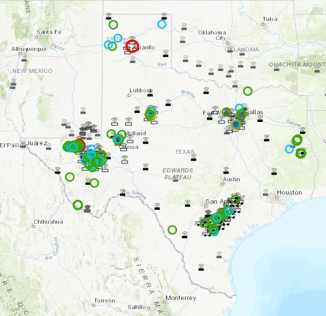
UT’s Bureau of Economic Geology has installed monitoring stations to record earthquakes across oil and gas fields in Texas, following the Legislature’s appropriation of funds for that purpose. It has been up and running since 1/1/17. Remember there was a big debate about whether oil and gas activities have resulted in earthquake activity. TexNet’s website has an interactive map that shows quakes of various magnitudes since that date. Snapshot below. You can see that quakes are centered in the active areas around the Permian, the Eagle Ford and the Barnett. Colors depict different magnitudes.
 Oil and Gas Lawyer Blog


